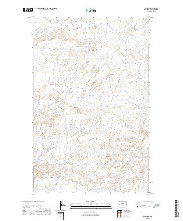
2024 Map of Gay Dam
USGS Topo · Published 2024About this map
Bitter Creek and its tributaries define the drainage patterns of this Valley County landscape, recorded in this contemporary survey. The terrain is marked by a series of deep coulees that cut through the high plains, including Long Coulee and the distinctively named Eagles Nest Coulee. These landforms provide a clear view of the hydrological network that sustains this part of Montana, where Willow Creek and Chisholm Creek flow through open country. The map detail illustrates the transition from high ridgelines to the winding paths of West Fork Bitter Creek, reflecting the natural erosion patterns common to the northern plains. This documentation serves as a precise modern baseline for understanding the physical geography and water resources of the region.
Find a feature on this map
13 named features on this map. Tap any name to fly to it.
Don’t see what you’re looking for? This feature index may not catch every label — zoom into the map to look around manually.
Map Details
Editions of this 2024 Gay Dam Map
This is the sole edition of this map. No revisions or reprints were ever made.
Other maps of this area

1919 · Boundary
USGS Topo · 1:125,000

1954 · Glasgow
USGS Topo · 1:250,000

1957 · Glasgow
USGS Topo · 1:250,000

1958 · Glasgow
USGS Topo · 1:250,000

1984 · Laundry Hill
USGS Topo · 1:24,000

1984 · Opheim
USGS Topo · 1:100,000

1984 · Gay Dam
USGS Topo · 1:24,000

1984 · Dodge Reservoir
USGS Topo · 1:24,000

1984 · Last Chance Reservoir
USGS Topo · 1:24,000
1984 · Forsman Reservoir
USGS Topo · 1:24,000