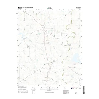
2014 Map of Gay
USGS Topo · Published 2014About this map
Gay and Molena anchor this rural landscape along the boundary of Meriwether and Pike counties. The area is defined by the winding course of the Flint River to the east and the many small family cemeteries that dot the countryside, including the BaughanStrozier Cem and Riggins Bagwell Cem. A notable piece of historical infrastructure is the Red Oak Creek Covered Bridge, which spans Red Oak Creek near the small settlement of Edman. The map reveals a transition from the agricultural uplands toward the river bottomlands at Flat Shoals, where the David Knott Bridge crosses the water. Numerous small lakes and millponds, such as Estes Lake and Jones Millpond, illustrate the historical reliance on local water sources for community and industry before modern development fully transformed the region.
Find a feature on this map
103 named features on this map. Tap any name to fly to it.
Don’t see what you’re looking for? This feature index may not catch every label — zoom into the map to look around manually.
Map Details
Editions of this 2014 Gay Map
This is the sole edition of this map. No revisions or reprints were ever made.
Other maps of this area

1907 · Talbotton
USGS Topo · 1:125,000

1934 · Warm Springs
USGS Topo · 1:62,500

1935 · Thomaston
USGS Topo · 1:48,000

1936 · Warm Springs
USGS Topo · 1:62,500

1939 · Thomaston
USGS Topo · 1:62,500

1953 · Atlanta
USGS Topo · 1:250,000

1955 · Phenix City
USGS Topo · 1:250,000

1957 · Phenix City
USGS Topo · 1:250,000

1957 · Atlanta
USGS Topo · 1:250,000

1958 · Phenix City
USGS Topo · 1:250,000