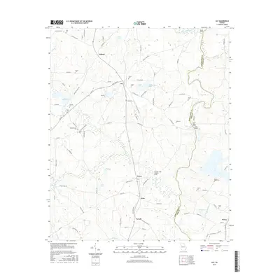
2017 Map of Gay
USGS Topo · Published 2017About this map
The Flint River carves a prominent boundary between Meriwether and Pike counties, anchoring a landscape defined by small crossroads settlements and historic family landmarks. This 2017 survey shows the enduring rural character of central Georgia, where the Red Oak Creek Covered Bridge stands as a significant architectural survivor near Edman. The geography is dotted with family-named burial grounds like Red Oak Cem and BaughanStrozier Cem, providing essential leads for genealogical research. Communities such as Gay and Imlac are connected by a network of local roads including Luthersville Rd and Greenville St. Water features like Jones Millpond and Little Creek suggest a long history of local water power and agricultural use, while the rocky terrain at Flat Shoals provides a distinct change in the river's character. Significant structures like the David Knott Bridge further highlight the historical importance of river crossings in this region.
Find a feature on this map
103 named features on this map. Tap any name to fly to it.
Don’t see what you’re looking for? This feature index may not catch every label — zoom into the map to look around manually.
Map Details
Editions of this 2017 Gay Map
This is the sole edition of this map. No revisions or reprints were ever made.
Other maps of this area

1907 · Talbotton
USGS Topo · 1:125,000

1934 · Warm Springs
USGS Topo · 1:62,500

1935 · Thomaston
USGS Topo · 1:48,000

1936 · Warm Springs
USGS Topo · 1:62,500

1939 · Thomaston
USGS Topo · 1:62,500

1953 · Atlanta
USGS Topo · 1:250,000

1955 · Phenix City
USGS Topo · 1:250,000

1957 · Phenix City
USGS Topo · 1:250,000

1957 · Atlanta
USGS Topo · 1:250,000

1958 · Phenix City
USGS Topo · 1:250,000