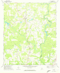
1971 Map of Gay
USGS Topo · Published 1973About this map
The Flint River forms a natural eastern boundary for Meriwether County in this early 1970s topographical record, defining a landscape of agriculture and small rail-side communities. The Seaboard Coast Line runs as a central spine through the region, connecting the primary settlement of Gay with smaller outposts like Edman, Imlac, and Carrolls. This period captures the rural character of the area before modern development, marked by numerous family burial grounds and community centers such as Red Oak Ch and New Friendship Ch. A notable landmark, the Covered Bridge, stands over a creek near the center of the sheet, representing a surviving piece of local infrastructure. Further south, the map details the outskirts of Molena where the Southern railroad line converges, highlighting the importance of the rail network to the local economy and settlement patterns along the Red Oak Creek watershed.
Find a feature on this map
43 named features on this map. Tap any name to fly to it.
Don’t see what you’re looking for? This feature index may not catch every label — zoom into the map to look around manually.
Map Details
Editions of this 1971 Gay Map
This is the sole edition of this map. No revisions or reprints were ever made.
Other maps of this area

1907 · Talbotton
USGS Topo · 1:125,000

1934 · Warm Springs
USGS Topo · 1:62,500

1935 · Thomaston
USGS Topo · 1:48,000

1936 · Warm Springs
USGS Topo · 1:62,500

1939 · Thomaston
USGS Topo · 1:62,500

1953 · Atlanta
USGS Topo · 1:250,000

1955 · Phenix City
USGS Topo · 1:250,000

1957 · Phenix City
USGS Topo · 1:250,000

1957 · Atlanta
USGS Topo · 1:250,000

1958 · Phenix City
USGS Topo · 1:250,000