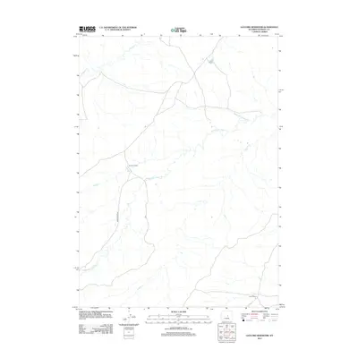
2012 Map of Gaylord Reservoir
USGS Topo · Published 2012About this map
Ranching outposts and drainage basins define this portion of Natrona County, where established homesteads like Davidson Ranch, Wyatt Ranch, and Morton Ranch remain the primary human landmarks. The landscape is shaped by the winding courses of Middle Fork Casper Cr, Coyote Cr, and Wallace Cr, which carve through the open plains and hills. Movement through this expanse is centered on Powder River Rd, a vital north-south artery connecting these isolated properties. This 2012 survey documents a contemporary view of the high plains, illustrating the persistence of large-scale land holdings and the reliance on seasonal watercourses in a region where the geography of the range still dictates the pattern of life.
Find a feature on this map
7 named features on this map. Tap any name to fly to it.
Don’t see what you’re looking for? This feature index may not catch every label — zoom into the map to look around manually.
Map Details
Editions of this 2012 Gaylord Reservoir Map
This is the sole edition of this map. No revisions or reprints were ever made.
Other maps of this area

1951 · Pine Mountain SW
USGS Topo · 1:24,000

1951 · Square Top Butte
USGS Topo · 1:24,000

1952 · Waltman
USGS Topo · 1:24,000

1955 · Arminto
USGS Topo · 1:250,000

1955 · Casper
USGS Topo · 1:250,000

1958 · Casper
USGS Topo · 1:250,000

1958 · Arminto
USGS Topo · 1:250,000

1959 · Gaylord Reservoir
USGS Topo · 1:24,000

1959 · Eightmile Draw
USGS Topo · 1:24,000

1959 · Broad Mesa
USGS Topo · 1:24,000