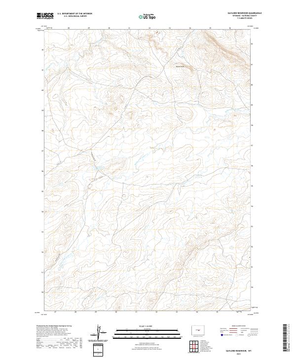
2021 Map of Gaylord Reservoir
USGS Topo · Published 2021About this map
Gaylord Reservoir sits at the center of this drainage system in the high plains of Natrona County. The landscape is defined by the intermittent flow of the Middle Fork Casper Cr and its various tributaries, including Coyote Cr and Wallace Cr. These waterways carve distinct paths through the township sections, creating a network of draws and basins such as Wyatt Draw. The presence of Powder River Rd and Co Rd 211 indicates the essential infrastructure required to navigate this portion of Wyoming. This map provides a clear view of the complex hydrology and the systematic land divisions that characterize the region, offering a precise look at the terrain as documented by the U.S. Geological Survey.
Find a feature on this map
11 named features on this map. Tap any name to fly to it.
Don’t see what you’re looking for? This feature index may not catch every label — zoom into the map to look around manually.
Map Details
Editions of this 2021 Gaylord Reservoir Map
This is the sole edition of this map. No revisions or reprints were ever made.
Other maps of this area

1951 · Pine Mountain SW
USGS Topo · 1:24,000

1951 · Square Top Butte
USGS Topo · 1:24,000

1952 · Waltman
USGS Topo · 1:24,000

1955 · Arminto
USGS Topo · 1:250,000

1955 · Casper
USGS Topo · 1:250,000

1958 · Casper
USGS Topo · 1:250,000

1958 · Arminto
USGS Topo · 1:250,000

1959 · Gaylord Reservoir
USGS Topo · 1:24,000

1959 · Eightmile Draw
USGS Topo · 1:24,000

1959 · Broad Mesa
USGS Topo · 1:24,000