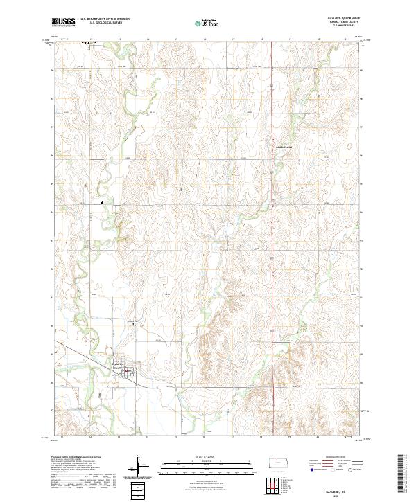
2022 Map of Gaylord
USGS Topo · Published 2022About this map
The North Fork Solomon River defines the southern reach of this landscape, where the settlement of Gaylord is situated along the riverbank. This Smith County region is characterized by a high-density network of section roads like 190 RD and Co RD 1060, which segment the rolling terrain between drainage systems such as Beaver Cr and Spring Cr. Local history is anchored by the small town grid of Gaylord, featuring streets like Main St and Gilman St, and the presence of the Po. Further north, the map shows the southern edge of Smith Center. Genealogy researchers will find interest in the documented locations of Christ Cem and Gaylord Cem, which serve as permanent markers of the area's rural community structure within the township and range divisions.
Find a feature on this map
30 named features on this map. Tap any name to fly to it.
Don’t see what you’re looking for? This feature index may not catch every label — zoom into the map to look around manually.
Map Details
Editions of this 2022 Gaylord Map
This is the sole edition of this map. No revisions or reprints were ever made.
Other maps of this area

1893 · Smith Center
USGS Topo · 1:125,000

1955 · Beloit
USGS Topo · 1:250,000

1959 · Beloit
USGS Topo · 1:250,000

1961 · Portis
USGS Topo · 1:24,000

1961 · Harlan
USGS Topo · 1:24,000

1961 · Gaylord SW
USGS Topo · 1:24,000

1973 · Athol
USGS Topo · 1:24,000
1973 · Cedar
USGS Topo · 1:24,000
1973 · Smith Center
USGS Topo · 1:24,000
1973 · Portis NW
USGS Topo · 1:24,000