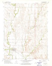
1973 Map of Gaylord
USGS Topo · Published 1975About this map
Gaylord sits at the confluence of the North Fork Solomon River and Spring Creek, serving as a focal point for this agricultural region during the early 1970s. The landscape is defined by its water management and transport infrastructure, including the Kirwin Main Canal and the Pacific railroad line that cuts through the southern portion of the quadrangle. Extensive irrigation networks are visible, supporting the surrounding farmland in Houston and Harlan townships.
Find a feature on this map
24 named features on this map. Tap any name to fly to it.
Don’t see what you’re looking for? This feature index may not catch every label — zoom into the map to look around manually.
Map Details
Editions of this 1973 Gaylord Map
This is the sole edition of this map. No revisions or reprints were ever made.
Other maps of this area

1893 · Smith Center
USGS Topo · 1:125,000

1955 · Beloit
USGS Topo · 1:250,000

1959 · Beloit
USGS Topo · 1:250,000

1961 · Portis
USGS Topo · 1:24,000

1961 · Harlan
USGS Topo · 1:24,000

1961 · Gaylord SW
USGS Topo · 1:24,000

1973 · Athol
USGS Topo · 1:24,000
1973 · Cedar
USGS Topo · 1:24,000
1973 · Smith Center
USGS Topo · 1:24,000
1973 · Portis NW
USGS Topo · 1:24,000