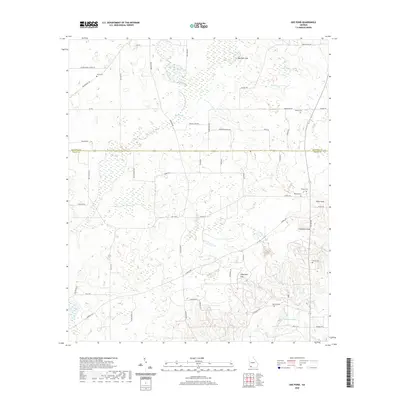
2020 Map of Gee Pond
USGS Topo · Published 2020About this map
The Mitchell and Grady County line divides this South Georgia landscape, where karst topography creates a unique network of depressions and water features. Prominent geological formations like Devils Den, Glory Hole, and Waterfall Sink punctuate the terrain, indicating the subsurface drainage common in this region. The northern section is dominated by the Bay Pole Sink and the winding course of the Big Slough, while the southern reaches feature Whigham Lake. Small family and community burial grounds, including Union Cem, Godwin Cem, and Wilder Cem, are scattered along rural routes such as Lodgetown Rd and Harrell Rd, providing essential points of reference for genealogists. This contemporary survey documents the intersection of agricultural land use and complex hydrology, from the tributaries of Kelly Cr to the wetlands bordering Sopp Cr.
Find a feature on this map
55 named features on this map. Tap any name to fly to it.
Don’t see what you’re looking for? This feature index may not catch every label — zoom into the map to look around manually.
Map Details
Editions of this 2020 Gee Pond Map
This is the sole edition of this map. No revisions or reprints were ever made.
Other maps of this area

1953 · Dothan
USGS Topo · 1:250,000

1954 · Dothan
USGS Topo · 1:250,000

1954 · Tallahassee
USGS Topo · 1:250,000

1955 · Dothan
USGS Topo · 1:250,000

1955 · Whigham
USGS Topo · 1:62,500

1956 · Cairo
USGS Topo · 1:62,500

1959 · Tallahassee
USGS Topo · 1:250,000

1960 · Tallahassee
USGS Topo · 1:250,000

1971 · Gee Pond
USGS Topo · 1:24,000

1971 · Vada
USGS Topo · 1:24,000