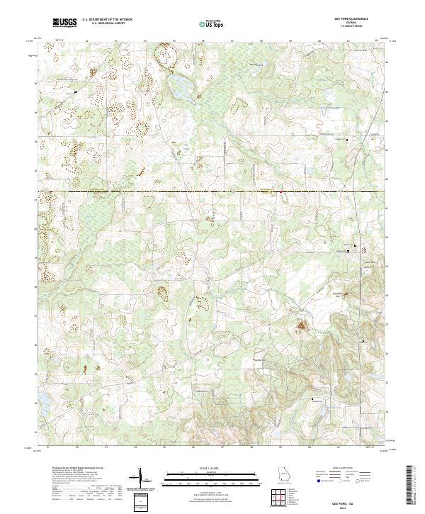
2024 Map of Gee Pond
USGS Topo · Published 2024About this map
The boundary between Mitchell Co and Grady Co bisects a landscape defined by dramatic karst topography and agricultural drainage. This rural Georgia region is punctuated by deep depressions and subterranean drainage points, including the aptly named Devils Den, Glory Hole, and Bay Pole Sink. These natural features reveal a complex underlying geology where surface waters like Big Slough and Kelly Creek disappear into the aquifer. Family names are deeply etched into the local road network, with routes like Crutch Field Rd, Chason Rd, and Gay Hammock Rd connecting the dispersed homesteads. For genealogists, the map preserves the locations of numerous community burial grounds, such as Union Cem, Godwin Cem, and Wilder Cem, which serve as quiet markers of the families who have long worked this limestone-rich terrain.
Find a feature on this map
57 named features on this map. Tap any name to fly to it.
Don’t see what you’re looking for? This feature index may not catch every label — zoom into the map to look around manually.
Map Details
Editions of this 2024 Gee Pond Map
This is the sole edition of this map. No revisions or reprints were ever made.
Other maps of this area

1953 · Dothan
USGS Topo · 1:250,000

1954 · Dothan
USGS Topo · 1:250,000

1954 · Tallahassee
USGS Topo · 1:250,000

1955 · Dothan
USGS Topo · 1:250,000

1955 · Whigham
USGS Topo · 1:62,500

1956 · Cairo
USGS Topo · 1:62,500

1959 · Tallahassee
USGS Topo · 1:250,000

1960 · Tallahassee
USGS Topo · 1:250,000

1971 · Gee Pond
USGS Topo · 1:24,000

1971 · Vada
USGS Topo · 1:24,000