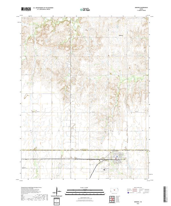
2022 Map of Geneseo
USGS Topo · Published 2022About this map
Geneseo sits at the southern edge of this Central Kansas landscape, positioned just below the Ellsworth Co Rice Co boundary line. The town's grid is clearly defined by residential streets like Worl Ave and Platt Ave, with the Geneseo Cem located just to the southwest. The surrounding countryside is defined by a dense network of sectional roads and the headwaters of several drainages, including the Little Arkansas River and Little Cow Cr. These waterways cut through the terrain, creating the distinct drainage patterns that characterize the transition between the rolling uplands and the river valley. To the north, the small settlement of Midway appears along the township line, while the Kansas Center Cem serves as a lone landmark in the western portion of the quadrangle. The map captures the enduring agricultural layout of the region, where section lines dictate the modern road network.
Find a feature on this map
41 named features on this map. Tap any name to fly to it.
Don’t see what you’re looking for? This feature index may not catch every label — zoom into the map to look around manually.
Map Details
Editions of this 2022 Geneseo Map
This is the sole edition of this map. No revisions or reprints were ever made.
Other maps of this area

1894 · Ellsworth
USGS Topo · 1:125,000

1894 · Lyons
USGS Topo · 1:125,000

1955 · Great Bend
USGS Topo · 1:250,000

1957 · Great Bend
USGS Topo · 1:250,000

1957 · Ellsworth
USGS Topo · 1:24,000
1957 · Carneiro
USGS Topo · 1:24,000

1957 · Holyrood NE
USGS Topo · 1:24,000

1958 · Great Bend
USGS Topo · 1:250,000
1964 · Crawford
USGS Topo · 1:24,000
1964 · Geneseo
USGS Topo · 1:24,000