
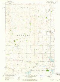
1958 Map of Geneseo
USGS Topo · Published 1960About this map
The town of Geneseo serves as a central point in this late 1950s survey of Sargent and Richland counties, where two major rail lines once intersected. The Minneapolis St Paul and Sault Ste Marie and the Great Northern railroads cross the landscape, shaping the development of this agricultural prairie. Local history is anchored by the St Martin Cem and School No 3, marking the rural social infrastructure of the mid-century.
Find a feature on this map
20 named features on this map. Tap any name to fly to it.
Don’t see what you’re looking for? This feature index may not catch every label — zoom into the map to look around manually.
Map Details
Editions of this 1958 Geneseo Map
This is the sole edition of this map. No revisions or reprints were ever made.
Other maps of this area

1907 · Wyndmere
USGS Topo · 1:125,000

1953 · Milbank
USGS Topo · 1:250,000

1953 · Fargo
USGS Topo · 1:250,000

1956 · Fargo
USGS Topo · 1:250,000

1958 · Milbank
USGS Topo · 1:250,000

1958 · Marlow
USGS Topo · 1:24,000

1958 · Veblen NE
USGS Topo · 1:24,000

1958 · Cayuga NW
USGS Topo · 1:24,000

1958 · Hamlin
USGS Topo · 1:24,000
1958 · Cayuga
USGS Topo · 1:24,000