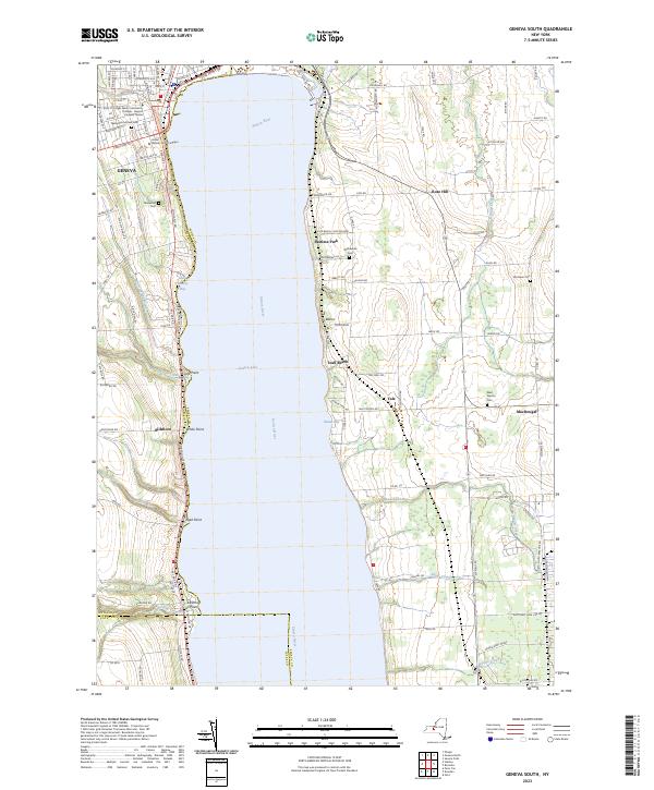
2023 Map of Geneva South
USGS Topo · Published 2023About this map
The western shores of Seneca Lake and the southern limits of Geneva define this landscape, where academic, military, and agricultural history converge. Hobart & William Smith Colleges occupies a prominent position on the shoreline, while further south, the massive footprint of the Seneca Army Depot dominates the eastern interior. This land-use pattern illustrates the regional significance of this corridor for both higher education and national defense during the mid-to-late 20th century.
Find a feature on this map
117 named features on this map. Tap any name to fly to it.
Don’t see what you’re looking for? This feature index may not catch every label — zoom into the map to look around manually.
Map Details
Editions of this 2023 Geneva South Map
This is the sole edition of this map. No revisions or reprints were ever made.
Other maps of this area

1902 · Geneva
USGS Topo · 1:62,500

1902 · Phelps
USGS Topo · 1:62,500

1902 · Ovid
USGS Topo · 1:62,500

1903 · Penn Yan
USGS Topo · 1:62,500

1942 · Penn Yan
USGS Topo · 1:31,680

1942 · Ovid
USGS Topo · 1:31,680

1942 · Stanley
USGS Topo · 1:31,680

1943 · Dresden
USGS Topo · 1:31,680

1943 · Geneva North
USGS Topo · 1:31,680

1943 · Geneva South
USGS Topo · 1:31,680