
1943 Map of Dresden
USGS Topo · Published 1943About this map
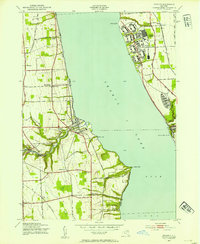
Seneca Lake bisects this wartime landscape, revealing a period of significant military and institutional presence along the shoreline. On the eastern bank, the massive Naval Training Station and its associated Sampson (PO) dominate the area near Kendaia, reflecting the rapid mobilization of the early 1940s. Further south, the Willard State Hospital complex occupies a prominent position on the coast near Willard. Across the water, the industrial character of the region is evident at the Outlet, where Mays Mills and Cascade Mills are situated along the drainage from Keuka Lake. The rural uplands of Benton and Milo are dotted with family-named crossroads like Ryal Corners and Townsend Corner, while historical burials are preserved at City Hill Cem and Angus Cem. The map captures the convergence of established agricultural life with the specialized infrastructure of a nation at war.
Find a feature on this map
47 named features on this map. Tap any name to fly to it.
Don’t see what you’re looking for? This feature index may not catch every label — zoom into the map to look around manually.
Map Details
Editions of this 1943 Dresden Map
4 editions found
Other maps of this area

1902 · Geneva
USGS Topo · 1:62,500

1902 · Phelps
USGS Topo · 1:62,500

1902 · Ovid
USGS Topo · 1:62,500

1903 · Penn Yan
USGS Topo · 1:62,500

1942 · Penn Yan
USGS Topo · 1:31,680

1942 · Ovid
USGS Topo · 1:31,680

1942 · Stanley
USGS Topo · 1:31,680

1942 · Dundee
USGS Topo · 1:24,000

1942 · Lodi
USGS Topo · 1:24,000

1942 · Keuka Park
USGS Topo · 1:24,000