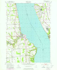
1943 Map of Dresden
USGS Topo · Published 1979About this map
The deep waters of Seneca Lake divide this 1940s landscape, which is marked by heavy military and institutional development on its eastern shore. Large installations such as the Seneca Army Depot and the Seneca Army Airfield dominate the terrain near Kendaia, while the Sampson State Park occupies a significant stretch of waterfront just north of the Willard State Hospital. On the western shore, the village of Dresden sits at the mouth of the Keuka Lake Outlet, where industrial sites like a Powerplant and Substation reflect the era's infrastructure.
Find a feature on this map
41 named features on this map. Tap any name to fly to it.
Don’t see what you’re looking for? This feature index may not catch every label — zoom into the map to look around manually.
Map Details
Editions of this 1943 Dresden Map
4 editions found

Other maps of this area

1902 · Geneva
USGS Topo · 1:62,500

1902 · Phelps
USGS Topo · 1:62,500

1902 · Ovid
USGS Topo · 1:62,500

1903 · Penn Yan
USGS Topo · 1:62,500

1942 · Penn Yan
USGS Topo · 1:31,680

1942 · Ovid
USGS Topo · 1:31,680

1942 · Stanley
USGS Topo · 1:31,680

1942 · Dundee
USGS Topo · 1:24,000

1942 · Lodi
USGS Topo · 1:24,000

1942 · Keuka Park
USGS Topo · 1:24,000