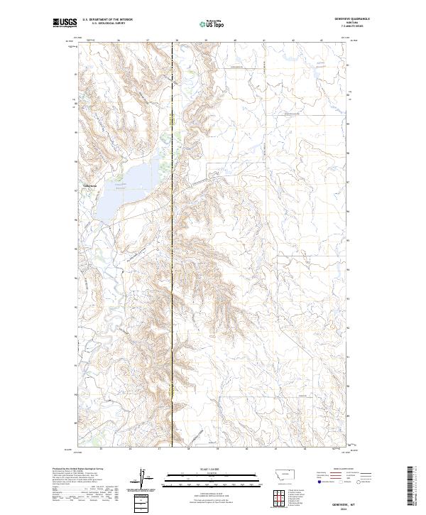
2024 Map of Genevieve
USGS Topo · Published 2024About this map
Frenchman Reservoir and Nelsons Reservoir dominate the hydrology of this high plains landscape, situated along the border of Phillips and Valley counties. The terrain is defined by a dense network of coulees, including Three Chimney Coulee, Bohner Coulee, and Panhandle Coulee, which drain toward the winding course of Frenchman Creek. The small settlement of Valleytown serves as a lone residential marker in an area otherwise characterized by livestock grazing and water management infrastructure.
Find a feature on this map
28 named features on this map. Tap any name to fly to it.
Don’t see what you’re looking for? This feature index may not catch every label — zoom into the map to look around manually.
Map Details
Editions of this 2024 Genevieve Map
This is the sole edition of this map. No revisions or reprints were ever made.
Other maps of this area

1954 · Glasgow
USGS Topo · 1:250,000

1957 · Glasgow
USGS Topo · 1:250,000

1958 · Glasgow
USGS Topo · 1:250,000

1984 · Bjornberg Bridge
USGS Topo · 1:24,000

1984 · Snake Creek School
USGS Topo · 1:24,000

1984 · Double S Hill
USGS Topo · 1:24,000
1984 · Jones Coulee
USGS Topo · 1:24,000

1984 · Coulter Coulee
USGS Topo · 1:24,000

1984 · Dead Horse Coulee
USGS Topo · 1:24,000
1984 · Papoose Hills
USGS Topo · 1:24,000