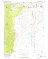
1968 Map of Genoa
USGS Topo · Published 1976About this map
The eastern front of the Sierra Nevada meets the agricultural expanse of the Carson Valley in this late 1960s survey. The historic town of Genoa sits at the base of several prominent drainages, including Genoa Canyon and Schoolhouse Canyon, where the Mormon Station Historic State Monument preserves the site of Nevada's earliest permanent non-native settlement. To the north, the Stewart Indian School and the community of Stewart occupy the landscape near the Carson City and Douglas County border. The map illustrates a transition from the wooded heights of the Toiyabe National Forest to the complex irrigation network of the valley floor, marked by the winding Carson River and the Carson Slough. Industrial and recreational footprints of the era are visible in the Nevada State Prison Railroad and the Tahoe-Carson Speedway, alongside local infrastructure like the Ormsby County Farm.
Find a feature on this map
46 named features on this map. Tap any name to fly to it.
Don’t see what you’re looking for? This feature index may not catch every label — zoom into the map to look around manually.
Map Details
Editions of this 1968 Genoa Map
3 editions found
Other maps of this area

1889 · Markleeville
USGS Topo · 1:125,000

1891 · Carson
USGS Topo · 1:125,000

1891 · Markleeville
USGS Topo · 1:125,000

1893 · Carson
USGS Topo · 1:125,000

1893 · Markleeville
USGS Topo · 1:125,000

1948 · Walker Lake
USGS Topo · 1:250,000

1955 · Bijou
USGS Topo · 1:24,000

1955 · Marlette Lake
USGS Topo · 1:24,000

1955 · Glenbrook
USGS Topo · 1:24,000

1956 · Freel Peak
USGS Topo · 1:62,500