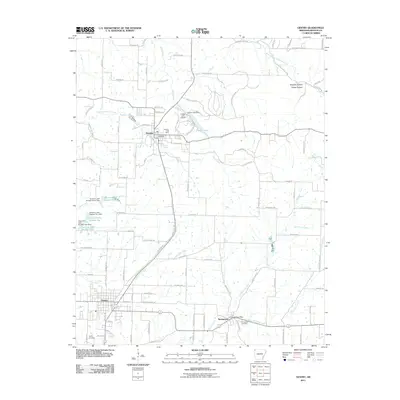
2011 Map of Gentry
USGS Topo · Published 2011About this map
Decatur and Gentry serve as the primary hubs in this part of Benton County, connected by a network of rural roads and the legacy of the rail corridor along Railroad Ln. The landscape is defined by the headwaters of several critical drainages, including Wolf Creek and Little Flint Creek, which carve through the plateau. Near the center of the map, Crystal Lake and its accompanying Crystal Lake Dam stand out alongside the Crystal Lake Airport, representing a concentrated area of mid-century infrastructure. Genealogists will find significant value in the documentation of local burial grounds such as Decatur Cemetery, Gentry Cemetery, and Springtown Cemetery. Further south, the small community of Springtown remains centered around its own Springtown Post Office near the banks of Flint Creek, while unique geological features like Corner Spring hint at the area's natural hydrology.
Find a feature on this map
56 named features on this map. Tap any name to fly to it.
Don’t see what you’re looking for? This feature index may not catch every label — zoom into the map to look around manually.
Map Details
Editions of this 2011 Gentry Map
This is the sole edition of this map. No revisions or reprints were ever made.
Other maps of this area

1899 · Fayetteville
USGS Topo · 1:125,000

1899 · Siloam Springs
USGS Topo · 1:125,000

1901 · Fayetteville
USGS Topo · 1:125,000

1903 · Siloam Springs
USGS Topo · 1:125,000

1904 · Siloam Springs
USGS Topo · 1:125,000

1904 · Fayetteville
USGS Topo · 1:125,000

1954 · Tulsa
USGS Topo · 1:250,000

1958 · Tulsa
USGS Topo · 1:250,000

1963 · Tulsa
USGS Topo · 1:250,000

1970 · Gallatin
USGS Topo · 1:24,000