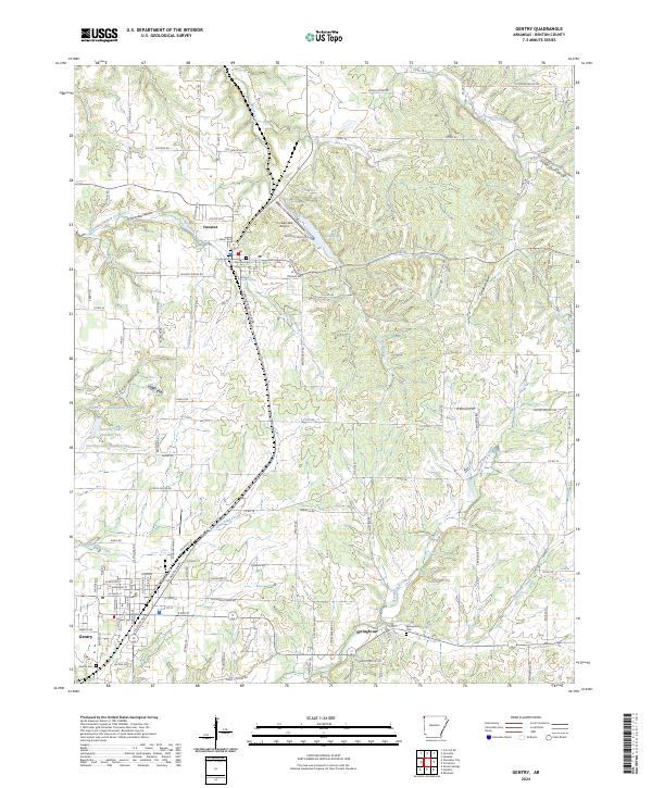
2024 Map of Gentry
USGS Topo · Published 2024About this map
Decatur and Gentry anchor the landscape of western Benton County, connected by the north-south corridor of the Kansas City Southern railroad. This modern survey illustrates a rural region defined by its hydrology, where spring-fed systems and hollows create a complex drainage network. Water is a central theme, from the clustered Guerrero Lake Number One, Two, and Three to the localized Corner Spring and the larger Crystal Lake near the Crystal Lake Airport.
Find a feature on this map
137 named features on this map. Tap any name to fly to it.
Don’t see what you’re looking for? This feature index may not catch every label — zoom into the map to look around manually.
Map Details
Editions of this 2024 Gentry Map
This is the sole edition of this map. No revisions or reprints were ever made.
Other maps of this area

1899 · Fayetteville
USGS Topo · 1:125,000

1899 · Siloam Springs
USGS Topo · 1:125,000

1901 · Fayetteville
USGS Topo · 1:125,000

1903 · Siloam Springs
USGS Topo · 1:125,000

1904 · Siloam Springs
USGS Topo · 1:125,000

1904 · Fayetteville
USGS Topo · 1:125,000

1954 · Tulsa
USGS Topo · 1:250,000

1958 · Tulsa
USGS Topo · 1:250,000

1963 · Tulsa
USGS Topo · 1:250,000

1970 · Gallatin
USGS Topo · 1:24,000