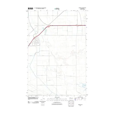
2011 Map of George
USGS Topo · Published 2011About this map
George sits at the intersection of local industry and highway transit in this early 21st-century portrait of the Columbia Basin. The town's grid is clearly defined by fruit-themed and presidential thoroughfares like Royal Anne Ave, Bing Ave, and Washington Way, reflecting the region’s agricultural roots and the unique nomenclature of the settlement. To the northeast, George Lake and Martha Lake provide small blue breaks in a landscape dominated by a vast network of irrigation-fed fields and rural section roads. The southern portion of the quadrangle is defined by the steady rise of Frenchman Hills Rd, where the terrain begins to shift away from the flat, cultivated basin floor. Further west, the small settlement of Burke marks an older point of transit near the junction of Beverly Burke Rd and the interstate frontage system.
Find a feature on this map
42 named features on this map. Tap any name to fly to it.
Don’t see what you’re looking for? This feature index may not catch every label — zoom into the map to look around manually.
Map Details
Editions of this 2011 George Map
This is the sole edition of this map. No revisions or reprints were ever made.
Other maps of this area

1909 · Quincy
USGS Topo · 1:62,500

1910 · Quincy
USGS Topo · 1:62,500

1910 · Winchester
USGS Topo · 1:62,500

1911 · Red Rock
USGS Topo · 1:62,500

1912 · Beverly
USGS Topo · 1:62,500

1950 · Smyrna
USGS Topo · 1:62,500

1951 · Smyrna
USGS Topo · 1:62,500

1953 · Walla Walla
USGS Topo · 1:250,000

1953 · Ritzville
USGS Topo · 1:250,000

1954 · Beverly NE
USGS Topo · 1:24,000