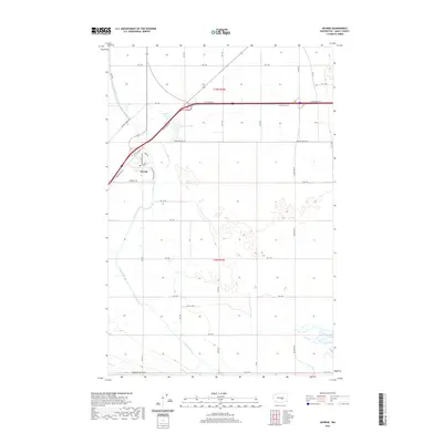
2020 Map of George
USGS Topo · Published 2020About this map
The community of George sits at the intersection of modern transit and irrigation-driven agriculture in this high desert region of Grant County. This modern survey illustrates the organized grid of the Columbia Basin Project, where the West Canal winds through the landscape to support local farms. The town site itself is defined by a distinct cluster of residential streets, including Washington Way and E Montgomery Blvd, surrounded by the wide expanse of T19N R24E. Nearby, George Lake and Martha Lake provide notable water features within the arid terrain. The map captures a transition point where major arterial roads like Baseline West Rd meet the rugged southern ascent toward Frenchman Hills Rd W, reflecting the area's continued reliance on the canal system and the interstate corridor for its economic identity.
Find a feature on this map
28 named features on this map. Tap any name to fly to it.
Don’t see what you’re looking for? This feature index may not catch every label — zoom into the map to look around manually.
Map Details
Editions of this 2020 George Map
This is the sole edition of this map. No revisions or reprints were ever made.
Other maps of this area

1909 · Quincy
USGS Topo · 1:62,500

1910 · Quincy
USGS Topo · 1:62,500

1910 · Winchester
USGS Topo · 1:62,500

1911 · Red Rock
USGS Topo · 1:62,500

1912 · Beverly
USGS Topo · 1:62,500

1950 · Smyrna
USGS Topo · 1:62,500

1951 · Smyrna
USGS Topo · 1:62,500

1953 · Walla Walla
USGS Topo · 1:250,000

1953 · Ritzville
USGS Topo · 1:250,000

1954 · Beverly NE
USGS Topo · 1:24,000