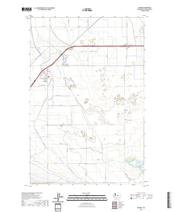
2023 Map of George
USGS Topo · Published 2023About this map
George stands as a distinct community in the high desert of Grant County, defined by a structured grid of residential streets like W Montmorency Blvd and Royal Anne Dr. The surrounding landscape is dominated by the industrial-scale agricultural geometry of the Columbia Basin Project, where the West Canal provides the essential water source for this arid region. This hydraulic infrastructure is the lifeblood of the local economy, visible in the sprawling network of service roads such as Baseline West Rd and Adams Rd SW that partition the fields. Small water bodies like George Lake and Martha Lake offer rare riparian breaks in the terrain near the interstate corridor. To the south, the land rises toward the Frenchman Hills Rd W, illustrating the transition from irrigated valley floors to the higher basalt ridges characteristic of central Washington.
Find a feature on this map
28 named features on this map. Tap any name to fly to it.
Don’t see what you’re looking for? This feature index may not catch every label — zoom into the map to look around manually.
Map Details
Editions of this 2023 George Map
This is the sole edition of this map. No revisions or reprints were ever made.
Other maps of this area

1909 · Quincy
USGS Topo · 1:62,500

1910 · Quincy
USGS Topo · 1:62,500

1910 · Winchester
USGS Topo · 1:62,500

1911 · Red Rock
USGS Topo · 1:62,500

1912 · Beverly
USGS Topo · 1:62,500

1950 · Smyrna
USGS Topo · 1:62,500

1951 · Smyrna
USGS Topo · 1:62,500

1953 · Walla Walla
USGS Topo · 1:250,000

1953 · Ritzville
USGS Topo · 1:250,000

1954 · Beverly NE
USGS Topo · 1:24,000