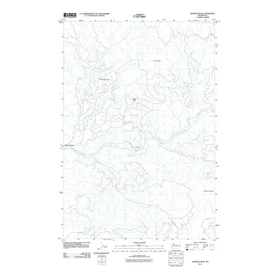
2011 Map of Georges Peak
USGS Topo · Published 2011About this map
Pigeon Springs and Camp Kalama anchor this landscape along the Kalama River in Cowlitz County. The terrain is defined by prominent elevations including Georges Peak and Shelley Mountain, with passage marked by Bear Pass and Wilkinson Saddle. A dense network of drainage systems such as Gobar Creek, Arnold Creek, and North Fork Elk Creek feeds the river system, illustrating the complex hydrography of the region. The presence of local routes like W Dubois Rd and Dart Rd suggests a network of access points through the heavily wooded and mountainous areas, providing essential context for those studying the intersection of natural topography and human infrastructure in the early 21st century.
Find a feature on this map
19 named features on this map. Tap any name to fly to it.
Don’t see what you’re looking for? This feature index may not catch every label — zoom into the map to look around manually.
Map Details
Editions of this 2011 Georges Peak Map
This is the sole edition of this map. No revisions or reprints were ever made.
Other maps of this area

1919 · Mount St Helens
USGS Topo · 1:125,000

1940 · La Center
USGS Topo · 1:62,500

1941 · Yacolt
USGS Topo · 1:62,500

1943 · Pigeon Springs
USGS Topo · 1:62,500

1948 · Vancouver
USGS Topo · 1:250,000

1950 · Vancouver
USGS Topo · 1:250,000

1950 · Vancouver
USGS Topo · 1:250,000

1953 · Hoquiam
USGS Topo · 1:250,000

1953 · Pigeon Springs
USGS Topo · 1:62,500

1953 · Cougar
USGS Topo · 1:62,500