
1967 Map of Georgetown
USGS Topo · Published 1967About this map
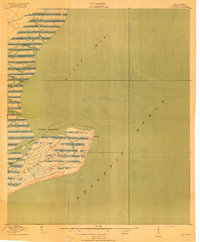
Winyah Bay serves as the focal point for this coastal region, where the Pee Dee River, Black River, and Waccamaw River converge at Georgetown. The landscape is defined by vast wetlands and managed timberlands, notably within the Francis Marion National Forest and the swampy recesses of Hell Hole Bay. Along the coast, the burgeoning mid-century tourism economy is evident in the string of beach communities stretching across Long Bay, from Myrtle Beach down to Pawleys Island. Transportation networks like the Atlantic Coast Line RR and the Intracoastal Waterway reveal the infrastructure supporting both the historical timber and naval stores industries and the modern era of seaside travel. Significant military history remains visible at the mouth of the Cape Fear River near Southport with the presence of Fort Caswell and Fort Fisher.
Find a feature on this map
134 named features on this map. Tap any name to fly to it.
Don’t see what you’re looking for? This feature index may not catch every label — zoom into the map to look around manually.
Map Details
Editions of this 1967 Georgetown Map
This is the sole edition of this map. No revisions or reprints were ever made.
Other maps of this area

1919 · Ladson
USGS Topo · 1:21,120

1919 · Summerville
USGS Topo · 1:48,000

1919 · Wando
USGS Topo · 1:21,120

1919 · Cordesville
USGS Topo · 1:48,000

1919 · Melgrove
USGS Topo · 1:21,120
1919 · Bulls Island
USGS Topo · 1:21,120

1919 · Sewee Bay
USGS Topo · 1:21,120

1920 · Chicora
USGS Topo · 1:48,000

1920 · Mayesville
USGS Topo · 1:48,000

1920 · Manning
USGS Topo · 1:48,000