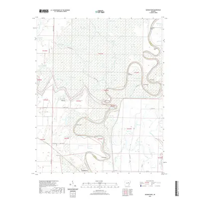
2020 Map of Georgetown
USGS Topo · Published 2020About this map
The confluence of the Little Red River and the White River defines this riverine landscape at the border of White County and Woodruff County. The settlement of Georgetown sits near the southern edge, connected by State Hwy 262 and Heathscott Rd to the interior wetlands. The terrain is characterized by complex hydrography, including the winding Glaise Creek, numerous oxbows like Whirl Lake, and named river bends such as Devils Elbow and Ealand Bend.
Find a feature on this map
62 named features on this map. Tap any name to fly to it.
Don’t see what you’re looking for? This feature index may not catch every label — zoom into the map to look around manually.
Map Details
Editions of this 2020 Georgetown Map
This is the sole edition of this map. No revisions or reprints were ever made.
Other maps of this area

1932 · Kensett
USGS Topo · 1:62,500

1935 · Kensett
USGS Topo · 1:62,500

1935 · Augusta
USGS Topo · 1:62,500

1935 · Gregory
USGS Topo · 1:62,500

1935 · Bald Knob
USGS Topo · 1:62,500

1953 · Memphis
USGS Topo · 1:250,000

1956 · Memphis
USGS Topo · 1:250,000

1957 · Augusta
USGS Topo · 1:62,500

1957 · Gregory
USGS Topo · 1:62,500
1964 · Jasmine
USGS Topo · 1:24,000