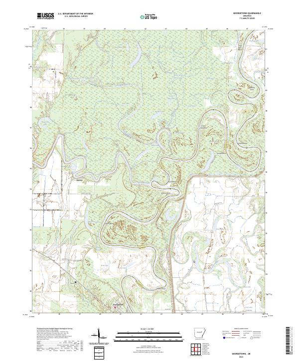
2024 Map of Georgetown
USGS Topo · Published 2024About this map
The confluence of the White River and the Little Red River dominates this hydrological landscape in the eastern corner of White County. The settlement of Georgetown sits at a sharp bend in the White River, positioned near the White Co Woodruff Co line. North of the town, the river system carves a complex series of oxbows and points including Devils Elbow, Graham Point, and Postal Bend. The terrain is defined by an intricate network of waterways, with Glaise Creek and Bear Slough feeding into the river system amidst numerous lakes like Hackelton Lake and Wolf Lake.
Find a feature on this map
66 named features on this map. Tap any name to fly to it.
Don’t see what you’re looking for? This feature index may not catch every label — zoom into the map to look around manually.
Map Details
Editions of this 2024 Georgetown Map
This is the sole edition of this map. No revisions or reprints were ever made.
Other maps of this area

1932 · Kensett
USGS Topo · 1:62,500

1935 · Kensett
USGS Topo · 1:62,500

1935 · Augusta
USGS Topo · 1:62,500

1935 · Gregory
USGS Topo · 1:62,500

1935 · Bald Knob
USGS Topo · 1:62,500

1953 · Memphis
USGS Topo · 1:250,000

1956 · Memphis
USGS Topo · 1:250,000

1957 · Augusta
USGS Topo · 1:62,500

1957 · Gregory
USGS Topo · 1:62,500
1964 · Jasmine
USGS Topo · 1:24,000