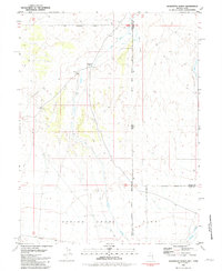
1981 Map of Georgetta Ranch
USGS Topo · Published 1981About this map
The Goshute Indian Reservation dominates this borderland landscape, where the high desert terrain of White Pine County meet the Utah state line. This 1981 survey documents the remote ranching and transit patterns of the Great Basin, anchored by the Georgetta Ranch and the nearby site of Eightmile. The geography is defined by narrow valley corridors and seasonal water sources like West Deep Creek and Fifteenmile Creek, which flow toward the broad Spring Creek Flat. Evidence of local travel and land use appears in the winding route of Whiskey Road and the industrial footprint of a Borrow Pit. Topographical landmarks such as The Narrows and Round Valley illustrate the dramatic relief of the region as it was recorded just before the 1980s.
Find a feature on this map
19 named features on this map. Tap any name to fly to it.
Don’t see what you’re looking for? This feature index may not catch every label — zoom into the map to look around manually.
Map Details
Editions of this 1981 Georgetta Ranch Map
This is the sole edition of this map. No revisions or reprints were ever made.
Other maps of this area

1908 · Fish Springs
USGS Topo · 1:250,000

1910 · Fish Springs
USGS Topo · 1:250,000

1925 · Gold Hill
USGS Topo · 1:62,500

1928 · Gold Hill
USGS Topo · 1:62,500

1953 · Tooele
USGS Topo · 1:250,000

1953 · Delta
USGS Topo · 1:250,000

1955 · Tooele
USGS Topo · 1:250,000

1955 · Elko
USGS Topo · 1:250,000

1956 · Ely
USGS Topo · 1:250,000

1958 · Elko
USGS Topo · 1:250,000