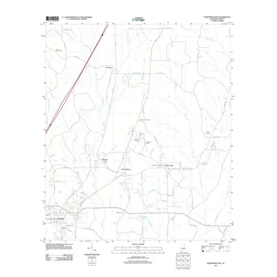
2011 Map of Georgiana East
USGS Topo · Published 2011About this map
The timber and transit town of Georgiana serves as the focal point for this Butler County landscape, where the rail-aligned community of Chapman and the rural settlement of Bolling sit along a corridor shaped by water and industry. The topography is defined by the winding course of Rocky Creek and Brushy Creek, which feed into local landmarks like McGowin Lake and Skippers Pond. Evidence of the area's forestry heritage is visible at the Chapman Lookout Tower, while agricultural and family roots are preserved in numerous community burial grounds, including Antioch West Cemetery and Oakwood Cemetery. The map details a transition from the structured street grids of the Georgiana Post Office area to the outlying developments of East Chapman, providing a clear view of the road networks that connect these Southern Alabama communities.
Find a feature on this map
76 named features on this map. Tap any name to fly to it.
Don’t see what you’re looking for? This feature index may not catch every label — zoom into the map to look around manually.
Map Details
Editions of this 2011 Georgiana East Map
This is the sole edition of this map. No revisions or reprints were ever made.
Other maps of this area

1953 · Andalusia
USGS Topo · 1:250,000

1957 · Andalusia
USGS Topo · 1:250,000

1971 · Industry
USGS Topo · 1:24,000

1971 · Greenville West
USGS Topo · 1:24,000

1971 · Pigeon Creek
USGS Topo · 1:24,000

1971 · Mc Kenzie
USGS Topo · 1:24,000

1971 · Greenville East
USGS Topo · 1:24,000

1971 · Georgiana East
USGS Topo · 1:24,000

1971 · Garland
USGS Topo · 1:24,000

1971 · Georgiana West
USGS Topo · 1:24,000