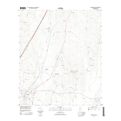
2014 Map of Georgiana East
USGS Topo · Published 2014About this map
The town of Georgiana sits at the southern edge of this Butler County landscape, serving as a focal point for a network of roads and rail lines that thread through the Piney Woods. The settlement pattern follows the drainage of Rocky Cr and Martin Cr, with clusters of activity at Bolling and Chapman. This survey illustrates the cultural landscape of the early 21st century, where timber and transit remain central to the region's character.
Find a feature on this map
80 named features on this map. Tap any name to fly to it.
Don’t see what you’re looking for? This feature index may not catch every label — zoom into the map to look around manually.
Map Details
Editions of this 2014 Georgiana East Map
This is the sole edition of this map. No revisions or reprints were ever made.
Other maps of this area

1953 · Andalusia
USGS Topo · 1:250,000

1957 · Andalusia
USGS Topo · 1:250,000

1971 · Industry
USGS Topo · 1:24,000

1971 · Greenville West
USGS Topo · 1:24,000

1971 · Pigeon Creek
USGS Topo · 1:24,000

1971 · Mc Kenzie
USGS Topo · 1:24,000

1971 · Greenville East
USGS Topo · 1:24,000

1971 · Georgiana East
USGS Topo · 1:24,000

1971 · Garland
USGS Topo · 1:24,000

1971 · Georgiana West
USGS Topo · 1:24,000