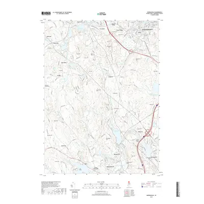
2018 Map of Georgiaville
USGS Topo · Published 2018About this map
Woonsocket and its surrounding mill-era villages dominate this Rhode Island landscape, where the Branch River and Woonasquatucket River carved the valleys that defined local settlement. The intricate water system of the northern Blackstone Valley is visible in the Slatersville Reservoirs and Stillwater Reservoir, resources that powered the industrial growth of communities like Slatersville, Forestdale, and Spragueville. This topography reveals the dense cluster of hills that hem in the river corridors, including Woonsocket Hill and Wionkhiege Hill, creating a distinct pattern of upland terrain and lowland development. In the south, the expansive campus of Bryant University sits near the winding Stillwater Pond, while the northern reach of the sheet captures the urban core of Globe and the historic Union Cemetery. The map also illustrates the transition from the city center to the wooded stretches of the Nipsachuck Hill area and the rocky outcroppings of The Blunders.
Find a feature on this map
82 named features on this map. Tap any name to fly to it.
Don’t see what you’re looking for? This feature index may not catch every label — zoom into the map to look around manually.
Map Details
Editions of this 2018 Georgiaville Map
This is the sole edition of this map. No revisions or reprints were ever made.
Other maps of this area

1886 · Blackstone
USGS Topo · 1:62,500

1887 · Franklin
USGS Topo · 1:62,500

1887 · Providence
USGS Topo · 1:62,500

1889 · Providence
USGS Topo · 1:62,500

1889 · Blackstone
USGS Topo · 1:62,500

1889 · Franklin
USGS Topo · 1:62,500

1889 · Burrillville
USGS Topo · 1:62,500

1893 · Franklin
USGS Topo · 1:62,500

1893 · Blackstone
USGS Topo · 1:62,500

1894 · Burrillville
USGS Topo · 1:62,500