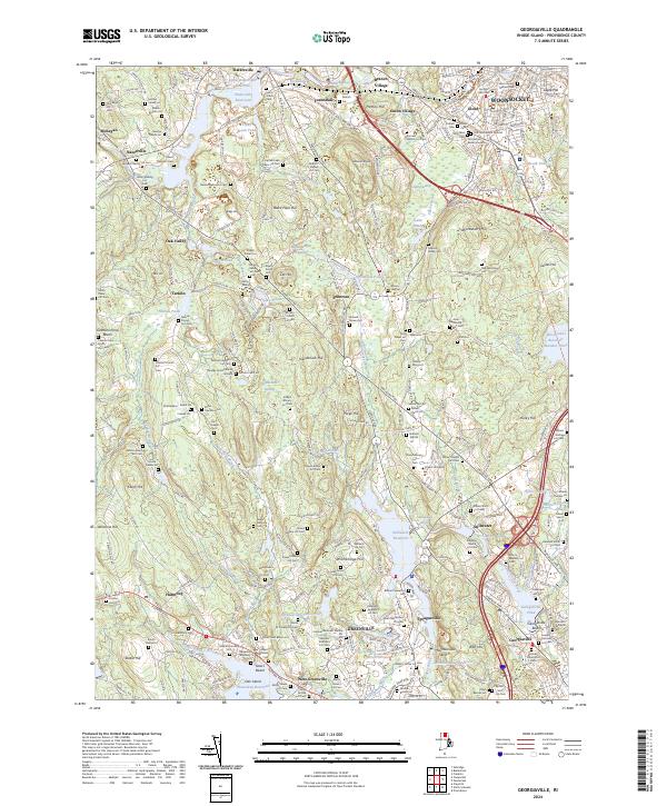
2024 Map of Georgiaville
USGS Topo · Published 2024About this map
Greenville and the surrounding villages of Providence County are defined by a dense network of family burial grounds and industrial waterways. The landscape is characterized by its numerous small-scale cemeteries, such as the George Arnold Burial Ground and Phetteplace - Keach Lot Cem, which provide a detailed genealogical record of the region's early families. The Woonasquatucket River system, including Stillwater Reservoir and Georgiaville Pond, highlights the historical importance of water power to local industry.
Find a feature on this map
253 named features on this map. Tap any name to fly to it.
Don’t see what you’re looking for? This feature index may not catch every label — zoom into the map to look around manually.
Map Details
Editions of this 2024 Georgiaville Map
This is the sole edition of this map. No revisions or reprints were ever made.
Other maps of this area

1886 · Blackstone
USGS Topo · 1:62,500

1887 · Franklin
USGS Topo · 1:62,500

1887 · Providence
USGS Topo · 1:62,500

1889 · Providence
USGS Topo · 1:62,500

1889 · Blackstone
USGS Topo · 1:62,500

1889 · Franklin
USGS Topo · 1:62,500

1889 · Burrillville
USGS Topo · 1:62,500

1893 · Franklin
USGS Topo · 1:62,500

1893 · Blackstone
USGS Topo · 1:62,500

1894 · Burrillville
USGS Topo · 1:62,500