
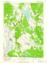
1960 Map of Gerber Reservoir
USGS Topo · Published 1961About this map
Gerber Reservoir dominates this high-desert landscape in southeastern Klamath County, serving as a focal point for water management and irrigation just north of the California border. The map reflects a mid-century period of established cattle ranching, with numerous homesteads and holdings like the Bieler Ranch, Johnson Ranch, and Casebeer Ranch scattered across the basin. In the northeastern corner, an Old Railroad Grade winds through the Fremont National Forest, indicating earlier industrial or logging activity that once reached these heights.
Find a feature on this map
81 named features on this map. Tap any name to fly to it.
Don’t see what you’re looking for? This feature index may not catch every label — zoom into the map to look around manually.
Map Details
Editions of this 1960 Gerber Reservoir Map
2 editions found
Other maps of this area

1886 · Alturas
USGS Topo · 1:250,000

1886 · Modoc Lava Bed
USGS Topo · 1:250,000

1889 · Klamath
USGS Topo · 1:250,000

1892 · Modoc Lava-Bed
USGS Topo · 1:250,000

1892 · Alturas
USGS Topo · 1:250,000

1894 · Klamath
USGS Topo · 1:250,000

1951 · Clear Lake Reservoir
USGS Topo · 1:62,500

1951 · Tulelake
USGS Topo · 1:62,500

1954 · Alturas
USGS Topo · 1:250,000

1955 · Klamath Falls
USGS Topo · 1:250,000