
1944 Map of Germantown
USGS Topo · Published 1944About this map
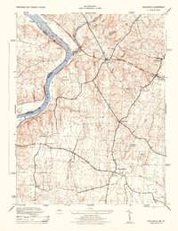
Baltimore and Ohio rail lines cut a diagonal path through this 1940s landscape of Montgomery County, anchoring a series of small rural communities and stopping points. The map documents the transition between older rural centers and the mid-century expansion, clearly distinguishing between Germantown and the site of Old Germantown. To the west, the settlements of Bucklodge and Bucklodge Sta appear along the tracks, surrounded by family-named landmarks like Thompsons Corner and Slidell.
Find a feature on this map
28 named features on this map. Tap any name to fly to it.
Don’t see what you’re looking for? This feature index may not catch every label — zoom into the map to look around manually.
Map Details
Editions of this 1944 Germantown Map
This is the sole edition of this map. No revisions or reprints were ever made.
Other maps of this area

1893 · Frederick
USGS Topo · 1:125,000

1894 · Frederick
USGS Topo · 1:125,000

1908 · Rockville
USGS Topo · 1:62,500

1908 · Seneca
USGS Topo · 1:62,500

1908 · Ijamsville
USGS Topo · 1:62,500

1909 · Mount Airy
USGS Topo · 1:62,500

1909 · Ijamsville
USGS Topo · 1:62,500

1923 · Rockville
USGS Topo · 1:62,500

1942 · Frederick
USGS Topo · 1:62,500
1944 · Poolesville
USGS Topo · 1:31,680