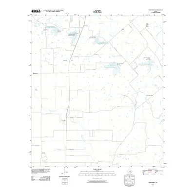
2010 Map of Geronimo
USGS Topo · Published 2010About this map
Geronimo and its surrounding rural landscape define this segment of Guadalupe County, appearing here during a period of managed water resources and established family landholdings. The terrain is marked by a series of flood control structures, including the Soil Conservation Service Site 8 Reservoir and the Soil Conservation Service Site 12 Reservoir, which reflect a 20th-century approach to managing the drainage of York Creek and Geronimo Creek. Small, clustered settlements like Barbarosa, Galle, and Harborth are linked by a network of farm-to-market roads, while local landmarks such as Hermann Hill and the Mill Creek Hills provide topographic relief.
Find a feature on this map
63 named features on this map. Tap any name to fly to it.
Don’t see what you’re looking for? This feature index may not catch every label — zoom into the map to look around manually.
Map Details
Editions of this 2010 Geronimo Map
This is the sole edition of this map. No revisions or reprints were ever made.
Other maps of this area

1911 · San Marcos
USGS Topo · 1:125,000

1919 · San Marcos
USGS Topo · 1:125,000

1924 · New Braunfels No 4
USGS Topo · 1:48,000

1924 · San Marcos 3-c
USGS Topo · 1:48,000

1924 · San Marcos 3-d
USGS Topo · 1:48,000

1925 · New Braunfels No 1
USGS Topo · 1:48,000

1927 · New Braunfels
USGS Topo · 1:62,500

1929 · Hunter
USGS Topo · 1:62,500

1930 · Seguin
USGS Topo · 1:62,500

1953 · Seguin
USGS Topo · 1:250,000