
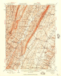
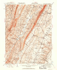
1937 Map of Gerrardstown
USGS Topo · Published 1937About this map
Apple Pie Ridge and North Mountain dominate this corner of the Shenandoah Valley, where the state lines of Virginia and West Virginia meet in a complex geography of ridges and creeks. This 1937 survey identifies a dense network of early rural social centers, including Hopewell Meeting House, Hetrick Chapel, and the Branson Sch. Transportation history is visible through the Pennsylvania RR corridor and the historic Braddock Road, alongside river crossings such as Warm Springs Ford and Abrils Ford. The map captures the agricultural and early industrial landscape before mid-century modernization, showing established settlements like Shockeysville, Clearbrook, and De Haven. The drainage patterns of Back Creek and Opequon Creek define the lowlands, while landmarks like Shockeys Knob provide vertical contrast to the valley floor's small farms and meeting houses.
Find a feature on this map
44 named features on this map. Tap any name to fly to it.
Don’t see what you’re looking for? This feature index may not catch every label — zoom into the map to look around manually.
Map Details
Editions of this 1937 Gerrardstown Map
3 editions found
Other maps of this area

1884 · Harpers Ferry
USGS Topo · 1:125,000

1891 · Harpers Ferry
USGS Topo · 1:125,000

1893 · Harpers Ferry
USGS Topo · 1:125,000

1894 · Winchester
USGS Topo · 1:125,000

1898 · Paw Paw
USGS Topo · 1:62,500

1899 · Hancock
USGS Topo · 1:62,500

1900 · Pawpaw
USGS Topo · 1:62,500

1901 · Hancock
USGS Topo · 1:62,500

1910 · Paw Paw
USGS Topo · 1:62,500

1912 · Williamsport
USGS Topo · 1:62,500