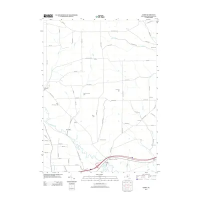
2013 Map of Gerry
USGS Topo · Published 2013About this map
Cassadaga Cr and its winding tributaries, including Folsom Cr and Hatch Cr, define the rural landscape of central Chautauqua County. This 2013 survey illustrates a region largely shaped by agricultural and nursery operations, such as Maple Hollow Farm, Kimvale Farms, and Bower And Bower Nursery Farm. The settlement of Gerry sits at a crossroads in the northwest, while the Chadakoin River flows through the southern portion of the quadrangle near Levant. Several family and community burial grounds are scattered across the hills, including Ross Mills Cem, Tucker Cem, and Valley View Cem, providing a detailed record for genealogists. The map also documents recreational and educational sites like the Jamestown Optimist Boys Camp and Breezewood Golf Links, reflecting the area's mix of modern land use and its deep-rooted rural character.
Find a feature on this map
73 named features on this map. Tap any name to fly to it.
Don’t see what you’re looking for? This feature index may not catch every label — zoom into the map to look around manually.
Map Details
Editions of this 2013 Gerry Map
This is the sole edition of this map. No revisions or reprints were ever made.
Other maps of this area

1900 · Dunkirk
USGS Topo · 1:62,500

1900 · Cherry Creek
USGS Topo · 1:62,500

1904 · Chautaqua
USGS Topo · 1:62,500

1905 · Jamestown
USGS Topo · 1:62,500

1941 · Cherry Creek
USGS Topo · 1:62,500

1941 · Chautauqua
USGS Topo · 1:62,500

1942 · Jamestown
USGS Topo · 1:62,500

1943 · Dunkirk
USGS Topo · 1:62,500
1954 · Kennedy
USGS Topo · 1:24,000

1954 · Ellery Center
USGS Topo · 1:24,000