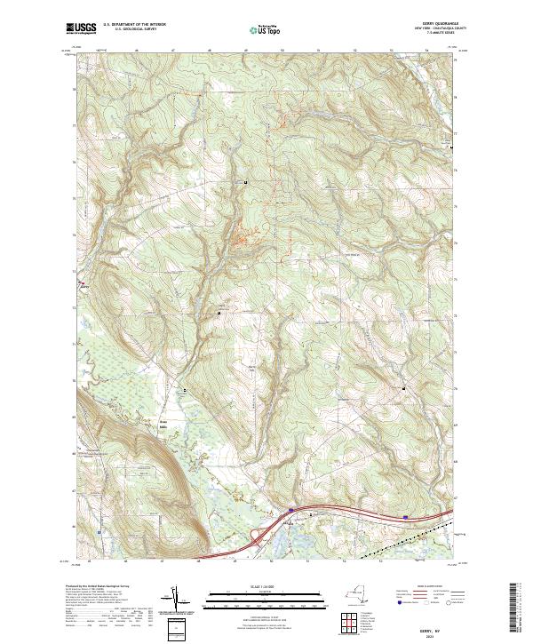
2023 Map of Gerry
USGS Topo · Published 2023About this map
Cassadaga Creek flows through the heart of this Chautauqua County landscape, defining a network of wetlands and river valleys that support the settlements of Gerry, Ross Mills, and Levant. The terrain is marked by numerous family-named landmarks and rural burying grounds, including the Gerry Hill Cem and Maple Grove Cem, which serve as vital touchstones for local genealogical research. In the southern reaches, the Chadakoin River meets the creek near the expansive Hartson Swamp, a complex hydrologic feature that contrasts with the elevated ridges of Harris Hill. This modern survey also captures the footprint of the Chautauqua County/Jamestown Airport, showing the intersection of traditional agricultural land use and contemporary infrastructure. The density of small cemeteries like Tucker Cem and Valley View Cem reflects a deeply rooted community structure along the old county touring routes.
Find a feature on this map
73 named features on this map. Tap any name to fly to it.
Don’t see what you’re looking for? This feature index may not catch every label — zoom into the map to look around manually.
Map Details
Editions of this 2023 Gerry Map
This is the sole edition of this map. No revisions or reprints were ever made.
Other maps of this area

1900 · Dunkirk
USGS Topo · 1:62,500

1900 · Cherry Creek
USGS Topo · 1:62,500

1904 · Chautaqua
USGS Topo · 1:62,500

1905 · Jamestown
USGS Topo · 1:62,500

1941 · Cherry Creek
USGS Topo · 1:62,500

1941 · Chautauqua
USGS Topo · 1:62,500

1942 · Jamestown
USGS Topo · 1:62,500

1943 · Dunkirk
USGS Topo · 1:62,500
1954 · Kennedy
USGS Topo · 1:24,000

1954 · Ellery Center
USGS Topo · 1:24,000