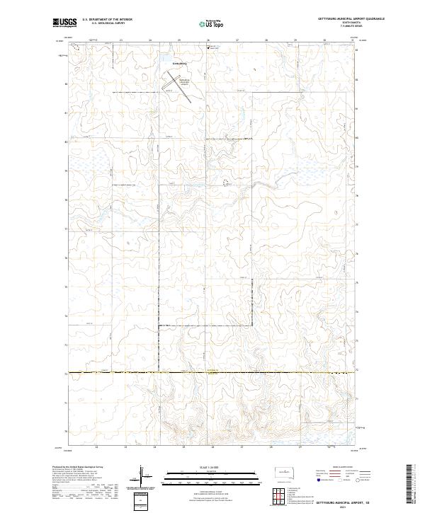
2021 Map of Gettysburg Municipal Airport
USGS Topo · Published 2021About this map
Gettysburg serves as the primary focal point of this 2021 survey, situated at the junction of the central prairie and the southern edge of Potter County. The landscape is characterized by its agricultural grid, defined by routes like 165th St and 172nd St, which crosses the boundary into Sully County. The Gettysburg Municipal Airport is a notable local landmark, supporting the region's aerial connectivity. For local historians and genealogists, the Sacred Heart Cem stands as a significant cultural site just north of the township. The drainage of the land is defined by the winding paths of Artichoke Cr and Okobojo Cr, which break the geometric precision of the section lines and offer a look at the natural hydrology that influenced the early platting of these townships.
Find a feature on this map
23 named features on this map. Tap any name to fly to it.
Don’t see what you’re looking for? This feature index may not catch every label — zoom into the map to look around manually.
Map Details
Editions of this 2021 Gettysburg Municipal Airport Map
This is the sole edition of this map. No revisions or reprints were ever made.
Other maps of this area

1953 · Huron
USGS Topo · 1:250,000

1953 · McIntosh
USGS Topo · 1:250,000

1954 · Aberdeen
USGS Topo · 1:250,000

1954 · Pierre
USGS Topo · 1:250,000

1954 · Huron
USGS Topo · 1:250,000

1956 · Aberdeen
USGS Topo · 1:250,000

1958 · Pierre
USGS Topo · 1:250,000

1958 · McIntosh
USGS Topo · 1:250,000

1965 · Agar
USGS Topo · 1:24,000
1970 · Agar NE
USGS Topo · 1:24,000