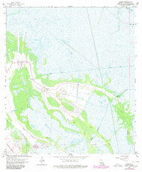
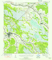
1963 Map of Gheens
USGS Topo · Published 1980About this map
The settlement of Gheens serves as a primary focal point in this coastal Louisiana landscape, situated along the Company Canal and surrounded by a network of bayous. The map captures the area as it transitioned through the 1960s and 1970s, illustrating the heavy influence of the petroleum industry with the sprawling Valentine Oil Field and numerous Drill Hole locations and pipelines. Local life is centered around institutions like St Anthony Ch, Gheens Ch, and a nearby Cem, which anchor the small community.
Find a feature on this map
25 named features on this map. Tap any name to fly to it.
Don’t see what you’re looking for? This feature index may not catch every label — zoom into the map to look around manually.
Map Details
Editions of this 1963 Gheens Map
4 editions found
Other maps of this area

1891 · Hahnville
USGS Topo · 1:62,500

1892 · Lac Des Allemands
USGS Topo · 1:62,500

1892 · Cut-Off
USGS Topo · 1:62,500

1892 · Houma
USGS Topo · 1:62,500

1932 · Houma SE
USGS Topo · 1:31,680

1932 · Lac Des Allemands SE
USGS Topo · 1:31,680

1932 · Houma NE
USGS Topo · 1:31,680

1932 · Hahnville SW
USGS Topo · 1:31,680

1939 · Cut-Off
USGS Topo · 1:62,500
1939 · Houma
USGS Topo · 1:62,500