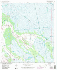
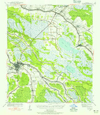
1963 Map of Gheens
USGS Topo · Published 1980About this map
Gheens and its surrounding wetlands represent the characteristic interface of settlement and marsh in 1960s Lafourche Parish. The landscape is defined by an intricate network of waterways, including the straight-cut Company Canal and Forty Arpent Canal, which stand in contrast to the natural winding course of Bayou Vacherie and Bayou Chateau de Cypres. This period shows the active extraction industry within the Valentine Oil Field, where numerous drill holes and oil wells dot the marshy terrain south of the main settlement.
Find a feature on this map
21 named features on this map. Tap any name to fly to it.
Don’t see what you’re looking for? This feature index may not catch every label — zoom into the map to look around manually.
Map Details
Editions of this 1963 Gheens Map
4 editions found
Other maps of this area

1891 · Hahnville
USGS Topo · 1:62,500

1892 · Lac Des Allemands
USGS Topo · 1:62,500

1892 · Cut-Off
USGS Topo · 1:62,500

1892 · Houma
USGS Topo · 1:62,500

1932 · Houma SE
USGS Topo · 1:31,680

1932 · Lac Des Allemands SE
USGS Topo · 1:31,680

1932 · Houma NE
USGS Topo · 1:31,680

1932 · Hahnville SW
USGS Topo · 1:31,680

1939 · Cut-Off
USGS Topo · 1:62,500
1939 · Houma
USGS Topo · 1:62,500