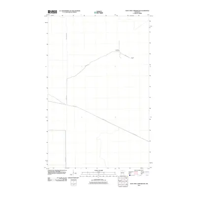
2010 Map of Giant Pine Campground
USGS Topo · Published 2010About this map
Mannila Camp and the Giant Pine Campground anchor this remote section of northern Minnesota, illustrating the deep connection between logging history and recreational land use. This landscape is defined by its drainage towards the South Fork Black River, which cuts across the western portion of the quadrangle. The sparse infrastructure consists primarily of forest access routes like Mannila Rd and Forest Rd 177, tracing the paths of earlier timber extraction and current wilderness management. The presence of Pine Island Rd further indicates the transition from heavy industrial forestry to state-managed conservation and public access areas in the early 21st century.
Find a feature on this map
6 named features on this map. Tap any name to fly to it.
Don’t see what you’re looking for? This feature index may not catch every label — zoom into the map to look around manually.
Map Details
Editions of this 2010 Giant Pine Campground Map
This is the sole edition of this map. No revisions or reprints were ever made.
Other maps of this area

1919 · Lundgren
USGS Topo · 1:62,500

1919 · I
USGS Topo · 1:62,500

1919 · Margie
USGS Topo · 1:62,500

1943 · Lindford
USGS Topo · 1:62,500

1954 · Roseau
USGS Topo · 1:250,000

1954 · International Falls
USGS Topo · 1:250,000

1957 · Roseau
USGS Topo · 1:250,000

1957 · International Falls
USGS Topo · 1:250,000

1958 · International Falls
USGS Topo · 1:250,000

1958 · Roseau
USGS Topo · 1:250,000