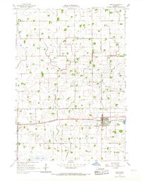
1964 Map of Gibbon
USGS Topo · Published 1968About this map
Gibbon serves as the primary hub of this Sibley County landscape, situated along the Chicago and North Western rail line during the mid-1960s. The surrounding prairie is defined by an extensive drainage network, including Judicial Ditch No 8 and County Ditch No 31, which transformed the wet terrain of Moltke and Severance townships into productive farmland. This era of agricultural transition is visible in the presence of the Alkali Lakebed and the southern reaches of Swan Lake. Local community life is anchored by rural landmarks such as St Peters Sch, a local Townhall, and several religious sites including Augustana Cem and St Willibrord Cem. Numerous Gravel Pits dot the countryside, reflecting the infrastructure needs of a growing rural road system.
Find a feature on this map
25 named features on this map. Tap any name to fly to it.
Don’t see what you’re looking for? This feature index may not catch every label — zoom into the map to look around manually.
Map Details
Editions of this 1964 Gibbon Map
3 editions found

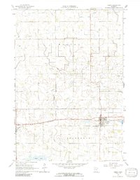
Other maps of this area

1953 · New Ulm
USGS Topo · 1:250,000

1957 · New Ulm
USGS Topo · 1:250,000

1958 · New Ulm
USGS Topo · 1:250,000

1958 · Winthrop
USGS Topo · 1:62,500

1964 · Fairfax
USGS Topo · 1:24,000

1964 · Sleepy Eye NW
USGS Topo · 1:24,000

1964 · Buffalo Lake
USGS Topo · 1:24,000

1964 · Lafayette
USGS Topo · 1:24,000

1964 · Hector
USGS Topo · 1:24,000

1964 · St George
USGS Topo · 1:24,000