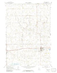
1964 Map of Gibbon
USGS Topo · Published 1991About this map
The agrarian landscape of Moltke and Severance townships is defined by an extensive drainage network, including Judicial Ditch No 8 and County Ditch No 22, designed to manage the low-lying prairie terrain. The settlement of Gibbon serves as the primary hub, situated along the Chicago and North Western railroad line. This rail connection was central to the local economy, facilitating the transport of agricultural goods from the surrounding farmsteads.
Find a feature on this map
25 named features on this map. Tap any name to fly to it.
Don’t see what you’re looking for? This feature index may not catch every label — zoom into the map to look around manually.
Map Details
Editions of this 1964 Gibbon Map
3 editions found

Other maps of this area

1953 · New Ulm
USGS Topo · 1:250,000

1957 · New Ulm
USGS Topo · 1:250,000

1958 · New Ulm
USGS Topo · 1:250,000

1958 · Winthrop
USGS Topo · 1:62,500

1964 · Fairfax
USGS Topo · 1:24,000

1964 · Sleepy Eye NW
USGS Topo · 1:24,000

1964 · Buffalo Lake
USGS Topo · 1:24,000

1964 · Lafayette
USGS Topo · 1:24,000

1964 · Hector
USGS Topo · 1:24,000

1964 · St George
USGS Topo · 1:24,000