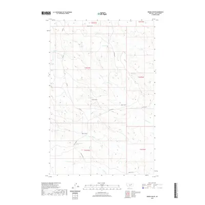
2020 Map of Gibson Coulee
USGS Topo · Published 2020About this map
Gibson Coulee and its surrounding drainage systems define this section of Valley County, where water sources are vital to the landscape. Numerous named springs, such as Chittick Spring, Andys Spring, and the uniquely named Half Moon Spring, suggest a history of seasonal water management and livestock grazing. These springs are primary nodes of activity in an otherwise high-plains terrain marked by deep coulees like Berry Coulee and Taylor Coulee.
Find a feature on this map
26 named features on this map. Tap any name to fly to it.
Don’t see what you’re looking for? This feature index may not catch every label — zoom into the map to look around manually.
Map Details
Editions of this 2020 Gibson Coulee Map
This is the sole edition of this map. No revisions or reprints were ever made.
Other maps of this area

1954 · Jordan
USGS Topo · 1:250,000

1956 · Jordan
USGS Topo · 1:250,000

1958 · Jordan
USGS Topo · 1:250,000

1964 · Jordan
USGS Topo · 1:250,000

1971 · Wolfe Coulee
USGS Topo · 1:24,000

1971 · Wagon Coulee
USGS Topo · 1:24,000

1971 · Harper Camp
USGS Topo · 1:24,000
1973 · Triple Crossing Reservoir East
USGS Topo · 1:24,000

1973 · Triple Crossing Reservoir West
USGS Topo · 1:24,000

1973 · Niles Coulee
USGS Topo · 1:24,000