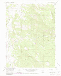
1963 Map of Gibson Gulch
USGS Topo · Published 1984This historical map portrays the area of Gibson Gulch in 1963, primarily covering Garfield County. Featuring a scale of 1:24000, this map provides a highly detailed snapshot of the terrain, roads, buildings, counties, and historical landmarks in the Gibson Gulch region at the time. Published in 1984, it is one of 6 known editions of this map due to revisions or reprints.
Find a feature on this map
31 named features on this map. Tap any name to fly to it.
Don’t see what you’re looking for? This feature index may not catch every label — zoom into the map to look around manually.
Map Details
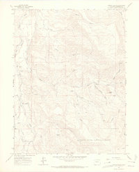
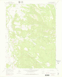
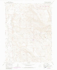
Editions of this 1963 Gibson Gulch Map
6 editions found

Historical Maps of Garfield County Through Time
97 maps found

1906 Grand Hogback
Garfield County, CO

1910 Grand Hogback
Garfield County, CO

1925 Parachute Creek
Garfield County, CO

1927 Parachute Creek
Garfield County, CO

1929 Grand Valley
Garfield County, CO

1929 Highmore
Garfield County, CO

1929 Roan Creek
Garfield County, CO

1952 Anvil Points
Garfield County, CO

1952 Horse Mountain
Garfield County, CO

1952 Rio Blanco
Garfield County, CO

1960 North Mamm Peak
Garfield County, CO

1960 Rulison
Garfield County, CO

1961 Shoshone
Garfield County, CO

1962 Red Pinnacle
Garfield County, CO

1962 Storm King Mountain
Garfield County, CO

1963 Center Mountain
Garfield County, CO

1963 Gibson Gulch
Garfield County, CO

1963 Hunter Mesa
Garfield County, CO

1964 Baxter Pass
Garfield County, CO

1964 Calf Canyon
Garfield County, CO

1964 Douglas Pass
Garfield County, CO

1964 Henderson Ridge
Garfield County, CO

1966 Deep Creek Point
Garfield County, CO

1966 Meadow Creek Lake
Garfield County, CO

1966 Red Elephant Point
Garfield County, CO

1966 Rifle Falls
Garfield County, CO

1966 Triangle Park
Garfield County, CO

1968 Carbonera
Garfield County, CO

1968 Garvey Canyon
Garfield County, CO

1968 Howard Canyon
Garfield County, CO

1968 Long Point
Garfield County, CO

1968 Middle Dry Fork
Garfield County, CO

1968 The Saddle
Garfield County, CO

1971 Bull Fork
Garfield County, CO

1971 Circle Dot Gulch
Garfield County, CO

1971 Cutoff Gulch
Garfield County, CO

1971 Desert Gulch
Garfield County, CO

1971 Forked Gulch
Garfield County, CO

1971 McCarthy Gulch
Garfield County, CO

1971 Mount Blaine
Garfield County, CO

1974 Adams Lake
Garfield County, CO

1974 Broken Rib Creek
Garfield County, CO

1974 Carbonate
Garfield County, CO

1977 Big Marvine Peak
Garfield County, CO

1977 Blair Mountain
Garfield County, CO

1977 Deep Lake
Garfield County, CO

1977 Devils Causeway
Garfield County, CO

1977 Dome Peak
Garfield County, CO

1977 Orno Peak
Garfield County, CO

1977 Sweetwater Lake
Garfield County, CO

1977 Trappers Lake
Garfield County, CO

2000 Devils Causeway
Garfield County, CO

2000 Orno Peak
Garfield County, CO

2022 Adams Lake
Garfield County, CO

2022 Anvil Points
Garfield County, CO

2022 Baxter Pass
Garfield County, CO

2022 Big Marvine Peak
Garfield County, CO

2022 Blair Mountain
Garfield County, CO

2022 Broken Rib Creek
Garfield County, CO

2022 Bull Fork
Garfield County, CO

2022 Calf Canyon
Garfield County, CO

2022 Carbonate
Garfield County, CO

2022 Carbonera
Garfield County, CO

2022 Center Mountain
Garfield County, CO

2022 Circle Dot Gulch
Garfield County, CO

2022 Cutoff Gulch
Garfield County, CO

2022 Deep Creek Point
Garfield County, CO

2022 Deep Lake
Garfield County, CO

2022 Desert Gulch
Garfield County, CO

2022 Devils Causeway
Garfield County, CO

2022 Dome Peak
Garfield County, CO

2022 Douglas Pass
Garfield County, CO

2022 Forked Gulch
Garfield County, CO

2022 Garvey Canyon
Garfield County, CO

2022 Gibson Gulch
Garfield County, CO

2022 Henderson Ridge
Garfield County, CO

2022 Horse Mountain
Garfield County, CO

2022 Howard Canyon
Garfield County, CO

2022 Hunter Mesa
Garfield County, CO

2022 Long Point
Garfield County, CO

2022 McCarthy Gulch
Garfield County, CO

2022 Meadow Creek Lake
Garfield County, CO

2022 Middle Dry Fork
Garfield County, CO

2022 Mount Blaine
Garfield County, CO

2022 North Mamm Peak
Garfield County, CO

2022 Orno Peak
Garfield County, CO

2022 Red Elephant Point
Garfield County, CO

2022 Red Pinnacle
Garfield County, CO

2022 Rifle Falls
Garfield County, CO

2022 Rio Blanco
Garfield County, CO

2022 Rulison
Garfield County, CO

2022 Shoshone
Garfield County, CO

2022 Storm King Mountain
Garfield County, CO

2022 Sweetwater Lake
Garfield County, CO

2022 The Saddle
Garfield County, CO

2022 Trappers Lake
Garfield County, CO

2022 Triangle Park
Garfield County, CO