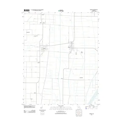
2012 Map of Gideon
USGS Topo · Published 2012About this map
The agricultural landscape of Dunklin County is defined by a grid of drainage infrastructure and small settlements. The community of Clarkton sits at the intersection of several county roads, while Gideon is positioned further east near the Gideon Memorial Airport. This 2012 survey illustrates the intensive water management required in this corner of Missouri, dominated by the Main Ditch District Number 17 to the north and Ditch Number 1 to the south. Local history is anchored by sites like Mount Gilead Cemetery near Page and the Stanfield Cemetery further south. Smaller named locales such as McGuire, Dunn, and Glendale are scattered across the quadrangle, connected by a network of rural routes including Co Rd-284 and Co Rd-334. The area maintains its rural character, with Sweetwater Camp providing a point of interest amidst the expansive fields and ditch systems.
Find a feature on this map
62 named features on this map. Tap any name to fly to it.
Don’t see what you’re looking for? This feature index may not catch every label — zoom into the map to look around manually.
Map Details
Editions of this 2012 Gideon Map
This is the sole edition of this map. No revisions or reprints were ever made.
Other maps of this area

1940 · Malden
USGS Topo · 1:62,500

1940 · Pascola
USGS Topo · 1:62,500

1940 · Valley Ridge
USGS Topo · 1:62,500

1940 · Piggott
USGS Topo · 1:62,500

1955 · Pascola
USGS Topo · 1:62,500

1956 · Valley Ridge
USGS Topo · 1:62,500

1956 · Piggott
USGS Topo · 1:62,500

1956 · Malden
USGS Topo · 1:62,500

1956 · Dyersburg
USGS Topo · 1:250,000

1957 · Poplar Bluff
USGS Topo · 1:250,000