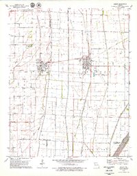
1978 Map of Gideon
USGS Topo · Published 1979About this map
The town of Gideon and the surrounding agricultural lowlands of the Missouri Bootheel define this 1970s landscape, where a massive system of drainage infrastructure transformed once-swampy terrain into productive farmland. An extensive network of numbered canals, including Ditch No 1 and Ditch No 2, crisscrosses the map, ultimately feeding into The Floodway and the Little River at the southern edge. This drainage system was essential for the development of settlements like Clarkton and the smaller community of McGuire.
Find a feature on this map
34 named features on this map. Tap any name to fly to it.
Don’t see what you’re looking for? This feature index may not catch every label — zoom into the map to look around manually.
Map Details
Editions of this 1978 Gideon Map
This is the sole edition of this map. No revisions or reprints were ever made.
Other maps of this area

1940 · Malden
USGS Topo · 1:62,500

1940 · Pascola
USGS Topo · 1:62,500

1940 · Valley Ridge
USGS Topo · 1:62,500

1940 · Piggott
USGS Topo · 1:62,500

1955 · Pascola
USGS Topo · 1:62,500

1956 · Valley Ridge
USGS Topo · 1:62,500

1956 · Piggott
USGS Topo · 1:62,500

1956 · Malden
USGS Topo · 1:62,500

1956 · Dyersburg
USGS Topo · 1:250,000

1957 · Poplar Bluff
USGS Topo · 1:250,000