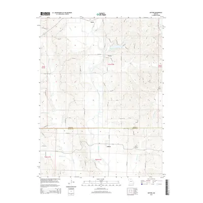
2015 Map of Gifford
USGS Topo · Published 2015About this map
The Chariton River valley serves as the central geographic feature of this mid-2010s survey, winding through the borderlands of Adair and Macon counties. Small settlements like Gifford and Yarrow anchor a landscape defined by an intricate network of local trails and county roads, reflecting a modern rural structure that maintains its historic land divisions. The terrain is deeply dissected by numerous watercourses, including Indian Creek, Sugar Creek, and Little Walnut Creek, creating a complex drainage pattern that has dictated the placement of homesteads and thoroughfares over generations.
Find a feature on this map
59 named features on this map. Tap any name to fly to it.
Don’t see what you’re looking for? This feature index may not catch every label — zoom into the map to look around manually.
Map Details
Editions of this 2015 Gifford Map
This is the sole edition of this map. No revisions or reprints were ever made.
Other maps of this area
1937 · Elmer
USGS Topo · 1:48,000
1938 · Kirksville
USGS Topo · 1:62,500
1940 · Kirksville
USGS Topo · 1:62,500
1942 · Elmer
USGS Topo · 1:62,500
1951 · New Boston
USGS Topo · 1:24,000
1953 · Moberly
USGS Topo · 1:250,000

1954 · Centerville
USGS Topo · 1:250,000
1954 · Moberly
USGS Topo · 1:250,000
1957 · Moberly
USGS Topo · 1:250,000
1957 · Centerville
USGS Topo · 1:250,000