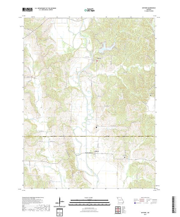
2021 Map of Gifford
USGS Topo · Published 2021About this map
The Chariton River valley serves as the central artery for this portion of Northern Missouri, where the meandering waterway carves through the landscape of Adair Co and Macon Co. Small communities such as Gifford and South Gifford sit near the southern border, while Yarrow is positioned further north, reflecting the traditional river-oriented settlement patterns of the region. The map reveals a network of named trails and county roads, such as Hedgehog Trl Run and Indian Hill Trl, that provide access to the timbered ridges and creek bottoms. For family historians, several burial sites are documented including Canaday Cem, Indian Hill Cem, and Sheridan Grove Cem. The local geography is further defined by numerous tributaries like Hog Cr, Sugar Cr, and Walnut Cr that feed into the main river channel, shaping the agricultural and residential layout of these rural townships.
Find a feature on this map
56 named features on this map. Tap any name to fly to it.
Don’t see what you’re looking for? This feature index may not catch every label — zoom into the map to look around manually.
Map Details
Editions of this 2021 Gifford Map
This is the sole edition of this map. No revisions or reprints were ever made.
Other maps of this area

1937 · Elmer
USGS Topo · 1:48,000

1938 · Kirksville
USGS Topo · 1:62,500

1940 · Kirksville
USGS Topo · 1:62,500

1942 · Elmer
USGS Topo · 1:62,500

1951 · New Boston
USGS Topo · 1:24,000

1953 · Moberly
USGS Topo · 1:250,000

1954 · Centerville
USGS Topo · 1:250,000

1954 · Moberly
USGS Topo · 1:250,000

1957 · Moberly
USGS Topo · 1:250,000

1957 · Centerville
USGS Topo · 1:250,000