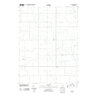
2010 Map of Gifford
USGS Topo · Published 2010About this map
The agricultural landscape of Jasper County is defined by an extensive network of man-made waterways and grid-based rural roads. Small settlements like Newland, Gifford, Lewiston, and Laura serve as the primary nodes of activity in this low-lying region. The terrain is heavily modified for drainage, as evidenced by dozens of named channels such as Grant Ditch, Oliver Ditch, and the winding Stalbaum Hershman Ditch. These ditches highlight the region's historic transformation into productive farmland.
Find a feature on this map
60 named features on this map. Tap any name to fly to it.
Don’t see what you’re looking for? This feature index may not catch every label — zoom into the map to look around manually.
Map Details
Editions of this 2010 Gifford Map
This is the sole edition of this map. No revisions or reprints were ever made.
Other maps of this area

1953 · Chicago
USGS Topo · 1:250,000

1953 · Danville
USGS Topo · 1:250,000

1955 · Danville
USGS Topo · 1:250,000

1956 · Danville
USGS Topo · 1:250,000

1957 · Chicago
USGS Topo · 1:250,000

1957 · Wheatfield
USGS Topo · 1:24,000

1957 · DeMotte
USGS Topo · 1:24,000

1959 · San Pierre
USGS Topo · 1:24,000

1962 · Medaryville
USGS Topo · 1:24,000

1962 · Gifford
USGS Topo · 1:24,000